
An inertial navigation system is one of the earliest known methods for determining the position and orientation of moving objects. While it lacks absolute accuracy and reliability – mainly due to error accumulation during measurement integration – it offers a key advantage: complete autonomy and independence from external signals. This makes inertial systems an enduring component of modern technology. They are widely used in missile and UAV guidance, submarine navigation, and spacecraft operations, where access to satellite or ground-based navigation signals may be limited or unavailable.
Read also: Weapons of Ukraine’s Victory: The Heavy Cruise Missile “Flamingo”
TABLE OF CONTENT:
The history of the emergence of inertial navigation systems
To understand how an inertial guidance system works, it helps to look back at the origins of navigation, which stretch back thousands of years.
In antiquity, seafaring was already fairly advanced, but venturing into open waters remained uncommon. Sailors mostly relied on what was known as coastal or cabotage navigation – moving along the shoreline. This approach was both convenient and relatively safe: visible landmarks reduced the risk of losing one’s way, while the ability to stop at shore each day allowed crews to rest and resupply.
![]()
The real challenge came when a vessel ventured into open sea, where no landmarks were available. How could sailors determine their exact position under such conditions?
Direction was relatively straightforward to track. Even before the compass, navigators used the Sun and stars to orient themselves. But knowing only the heading was not enough – plotting a course line on a map still left the crucial question unanswered: without information about the distance traveled, it was impossible to pinpoint the ship’s actual location.
To solve this, sailors relied on a simple yet effective principle: distance equals speed multiplied by time. Time was measured with hourglasses, while the ship’s speed was determined using a log line – a rope with knots and a weight that was thrown overboard, with the number of knots “passed” over a set period counted. Knowing both speed and time allowed navigators to calculate the distance traveled and, combined with the heading, determine the ship’s coordinates.
In essence, this method represents the first practical implementation of inertial navigation. It is based on tracking an object’s movement by integrating its speed over time. Despite technological advancements, the underlying principle remains the same today.
![]()
Today, it might seem that the advent of satellite navigation has made inertial methods obsolete. However, that is not the case. GPS and other satellite systems do provide high accuracy, but they rely on external signals. In situations where these signals are unavailable or jammed, inertial navigation remains a fundamental tool for determining position and orientation.
Read also: Weapons of Ukraine’s Victory: Modern Long-Range ERAM Missiles
Inertial missile guidance system
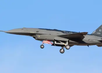
Inertial systems are most often mentioned in the context of missile technology, as they form the core of guidance systems. However, their use is not limited to the military. The principles of inertial navigation are also applied in civilian transport, including ships and aircraft. In such settings, inertial units are typically integrated with other positioning tools, primarily satellite navigation systems, to enhance accuracy and reliability.
![]()
In civilian transport, the need for fully autonomous position tracking is rare, as GPS outages or intentional signal jamming are uncommon. In this context, inertial systems serve a supporting role: they maintain continuous navigation, compensate for short-term signal losses, and improve overall reliability.
![]()
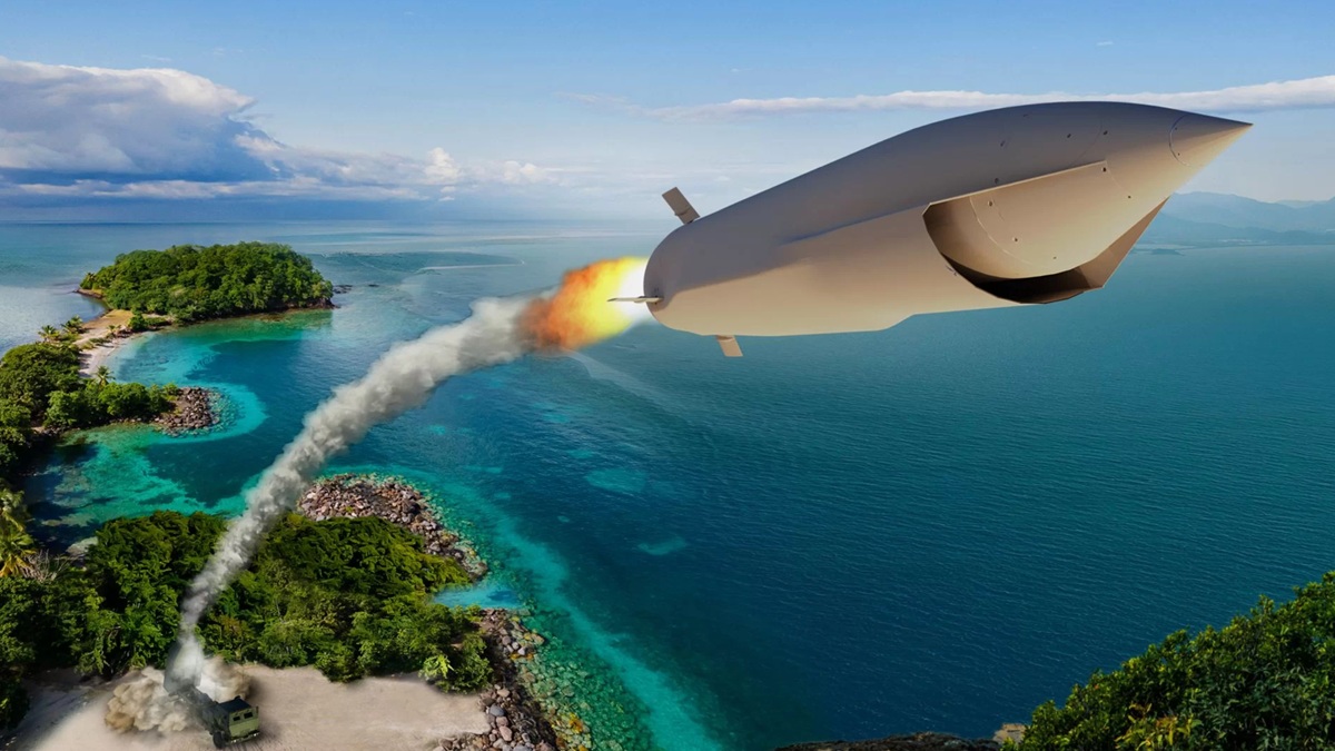
The situation is different in the military sector. Cruise missiles face a significant risk of losing access to external references due to active electronic countermeasures by the enemy. In such cases, inertial navigation remains the primary guidance method. For intercontinental ballistic missiles, the challenge is different: during the midcourse phase, they travel outside the atmosphere, where satellite navigation signals are unavailable. Here, combining inertial navigation with astro-correction – orientation using stars – ensures the necessary accuracy for hitting the target.
In this way, the versatility of inertial systems lies in their ability to operate independently of external signals, making them indispensable in both military and civilian applications, though with varying levels of importance and different usage scenarios.
Read also: Thrust Reversal: How and When an Aircraft Uses Engine Braking
How an inertial navigation system (INS) works
An inertial navigation system (INS) is an autonomous set of measurement instruments and computing tools designed to determine an object’s position, velocity, and orientation relative to a chosen reference frame, without relying on external information sources.
An INS relies on two main types of sensors:
- Accelerometers, which measure linear acceleration along mutually perpendicular axes.
- Gyroscopes, which record angular rotation rates.
In practice, the measured values are integrated over time. The typical sequence of calculations is as follows:
- Angular rates are used to determine the orientation of the moving object in space.
- Accelerations, projected onto the chosen coordinate system, are integrated to obtain instantaneous velocity.
- Integrating the velocity again provides an estimate of displacement and the current position.
In this way, an inertial system implements the principle of “dead reckoning,” determining an object’s position by accumulating information about its own motion parameters.
Images of devices used in inertial navigation systems are widely available online. A particularly notable example is the instrument installed in the Concorde 01 aircraft – the first prototype of the supersonic Concorde airliner.
![]()
In modern navigation systems, an INS is typically combined with other sources of navigational data, such as GNSS, astro-navigation, or radio beacons. Data from these sources are integrated using optimal filtering algorithms, most notably the Kalman filter, which helps compensate for drift and improve the system’s long-term accuracy.
Read also: Swift Beat’s Shahed Interceptor Drone: What We Know
Advantages of inertial navigation systems
Inertial navigation systems (INS) occupy a unique position among methods for determining the position and orientation of moving objects. While they fall short of satellite or radio navigation systems in long-term accuracy, their strengths make them indispensable in many applications.
Foremost among these advantages is autonomy. Unlike GPS, an INS does not rely on external signals, instead using measurements from its own accelerometers and gyroscopes. This allows the system to operate independently of environmental conditions, which is especially valuable when external sources of information are unavailable or compromised.
![]()
A second key advantage is resilience to interference and jamming. Satellite navigation can be easily blocked or disrupted through signal jamming or electronic warfare techniques. In contrast, an inertial system operates independently of such external factors, making it critically important in military applications – such as for cruise or ballistic missiles that must remain operational even in environments with active electronic countermeasures.
A third major strength is high responsiveness and continuous operation. An INS can generate navigation data hundreds or even thousands of times per second, allowing precise tracking of even the fastest maneuvers. The system continues to function during periods when external navigation sources are temporarily unavailable, ensuring an uninterrupted flow of information.
![]()
A fourth advantage is the versatility of operating conditions. Inertial systems can function effectively where other navigation methods fail: underwater, in tunnels, deep mines or caves, and in space, where satellite signals are unavailable. This makes INS a near-universal solution for navigation tasks in environments with limited access to external references.
Modern inertial sensors are also compact and flexible to integrate. MEMS technology allows the production of miniature sensors that can be embedded in consumer devices such as smartphones or drones, while high-precision laser or fiber-optic gyroscopes are used in advanced navigation systems for aircraft, submarines, and spacecraft.
Finally, it is worth noting the reliability and longevity of inertial units. Modern sensors, particularly laser, fiber-optic, and MEMS gyroscopes, have no moving parts, making their performance largely unaffected by mechanical wear and giving them a very long operational lifespan.
In summary, the strengths of INS – autonomy, resistance to external interference, versatility, and high responsiveness – make them indispensable in applications where navigation reliability is critical. Despite drawbacks such as error accumulation and the need for occasional correction, inertial systems remain a fundamental component of modern integrated navigation solutions.
Read also: Is Space Becoming the New Battlefield?
Drawbacks of inertial navigation systems
Despite their many advantages, inertial navigation systems have several significant drawbacks that limit their use in standalone form and create the need to combine them with other navigation methods.
The most critical limitation of an INS is error accumulation over time. Because the system determines position by integrating measurements of acceleration and angular rates, even the smallest sensor error gradually leads to substantial deviation from the true trajectory. This phenomenon is known as drift. In practice, this means that without periodic correction using external references – such as satellite signals or astro-navigation data – the accuracy of an INS deteriorates rapidly.
![]()
A historical example of inertial navigation development can be seen in the world’s first ballistic missile – the V-2 (A-4), developed in Nazi Germany under Werner von Braun. This missile had limited guidance accuracy: initially, its error margin was around ±20 km, making it capable of striking an entire city but not specific targets within it. Improvements to the system reduced the error to roughly ±10 km. Considering the missile’s maximum range of about 250 km, even these enhancements highlight the significant limitations of inertial guidance at the time.
Another important drawback is the high cost of high-precision systems. While MEMS sensors are relatively affordable, they offer lower accuracy. In contrast, laser and fiber-optic gyroscopes are much more expensive and are primarily used in military and aviation applications. This cost factor limits their widespread adoption in civilian transport, especially in areas where reliable satellite navigation is already available.
A third limitation is the restricted long-term accuracy without external support. Unlike GPS or other satellite systems, which provide consistent global positioning, an INS can maintain an acceptable error margin only for a relatively short period. Beyond that, errors grow exponentially, making the system unsuitable for long-duration navigation without correction.
Another factor is sensitivity to sensor quality. The performance of an INS heavily depends on the characteristics of its accelerometers and gyroscopes: noise, zero drift, and temperature variations all directly affect final accuracy. As a result, inexpensive inertial modules commonly found in smartphones or consumer electronics can provide only approximate orientation, rather than precise navigation.
It is also important to consider the complexity of signal processing. Accurate INS operation requires sophisticated algorithms for integration, noise filtering, and error compensation. This demands significant computational resources, which can be a critical limitation in low-power or energy-constrained systems.
In summary, the main challenges of inertial navigation systems are:
- Rapid accumulation of errors
- High cost of high-precision models
- Dependence on sensor quality
- Need for periodic correction using external data sources
For this reason, modern INS is rarely used in isolation. It is typically part of integrated navigation systems, combined with GPS, astro-correction, magnetometers, or other methods that help compensate for its inherent limitations.
![]()
Modern inertial navigation systems far surpass their historical counterparts thanks to high-precision sensors, including laser gyroscopes and optical accelerometers. The improved measurement accuracy can reduce errors to around 0.01% of the distance traveled. However, even this level of precision has limits over long distances: for a submarine, it could be across an entire ocean, and for a spacecraft, interplanetary distances, where accumulated drift errors become critical.
Despite these physical limitations, inertial systems remain a primary tool for guidance and navigation and continue to be refined. Interestingly, the fundamental principle has stayed the same: modern gyroscopes and accelerometers perform the same basic function as the compass and log line with rope and weight used by sailors centuries ago. From simple mechanical instruments of the age of sails and oars to high-precision electronic navigation, the core idea – measuring an object’s movement and calculating its position – has endured. This demonstrates that the basic principles of inertial navigation remain relevant even for planning interplanetary missions, where system autonomy and reliability are critical.
Read also:

